Sunday, August 27, 2006


Foiled again by idiots playing games with RADAR locks.
http://static.flickr.com/72/226337074_53fe0cc6bf_b.jpg

I could not get into Bridge Wood today because some idiot has put the lock at the bottom of the gate where I cannot reach. How childish? Surely the council worker who visits the site every day saw this nonsense.
I also went to Pipers Vale and guess what. The RADAR lock there doesn't work so I went to Felixstowe instead for the day.
peterturtill@hotmail.com

Saturday, August 26, 2006


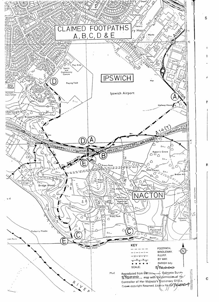
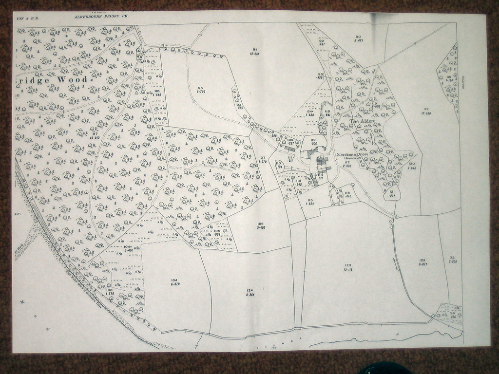
This is a Public Footpath leading to Bridge Wood owned by IBC.
It is a right of anybody to walk along here according to
Suffolk County Council but that doesn't mean there are no
other rights too such as driving along here or riding a horse,
bicycle or motorbicycle. It is also legal for any obstruction
to a Right Of Way to be removed providing the person is
actually going that way. It is not legal to just go there to
remove the obstruction. One must actually be going that
way and be obstructed until they have removed the
obstruction and continued or at least to have started off with
the intention to walk that way before being obstructed.
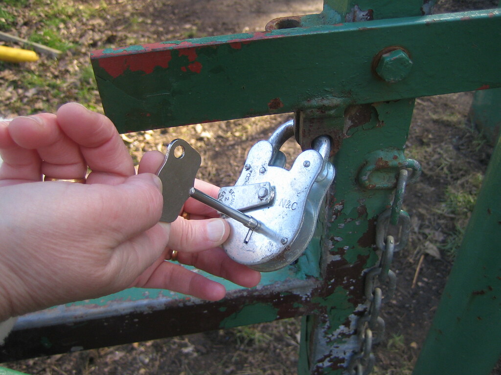
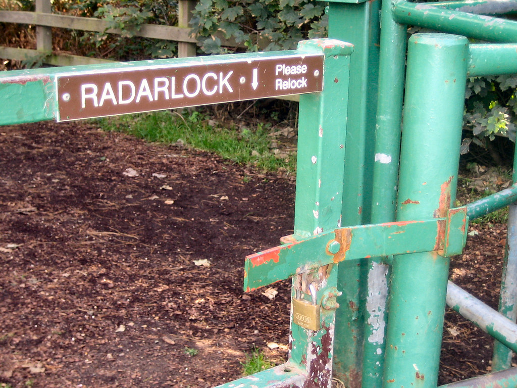
http://static.flickr.com/46/114359869_2c1600459e_b.jpg
This is a RADAR lock at Bridgewood. A RADAR lock allows
disabled people with a key to gain access. It also allows
youngsters on motorcycles to use grannies key to get in:-)
In this instance it is an unlawful obstruction to a
Right Of Way.
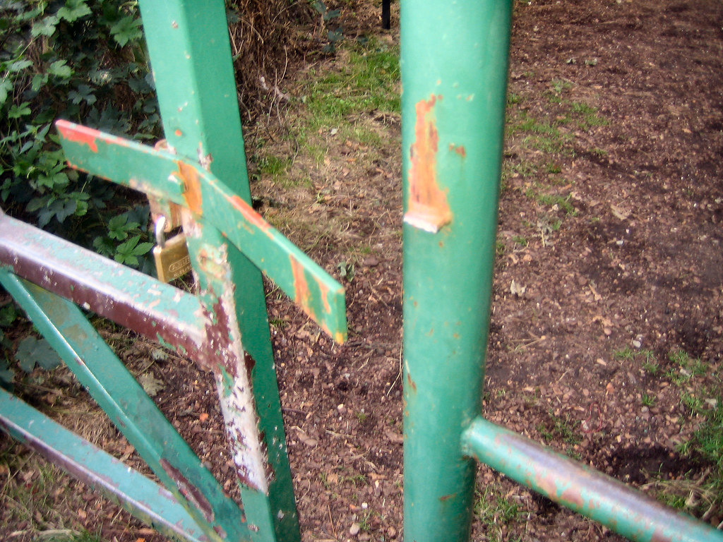
http://static.flickr.com/51/112723143_5f120d2a5b_b.jpg
This is not a RADAR lock so disabled people can no longer
use this gate and a Footpath is further blocked unlawfully
by IBC who own the path but not the right to obstruct it.
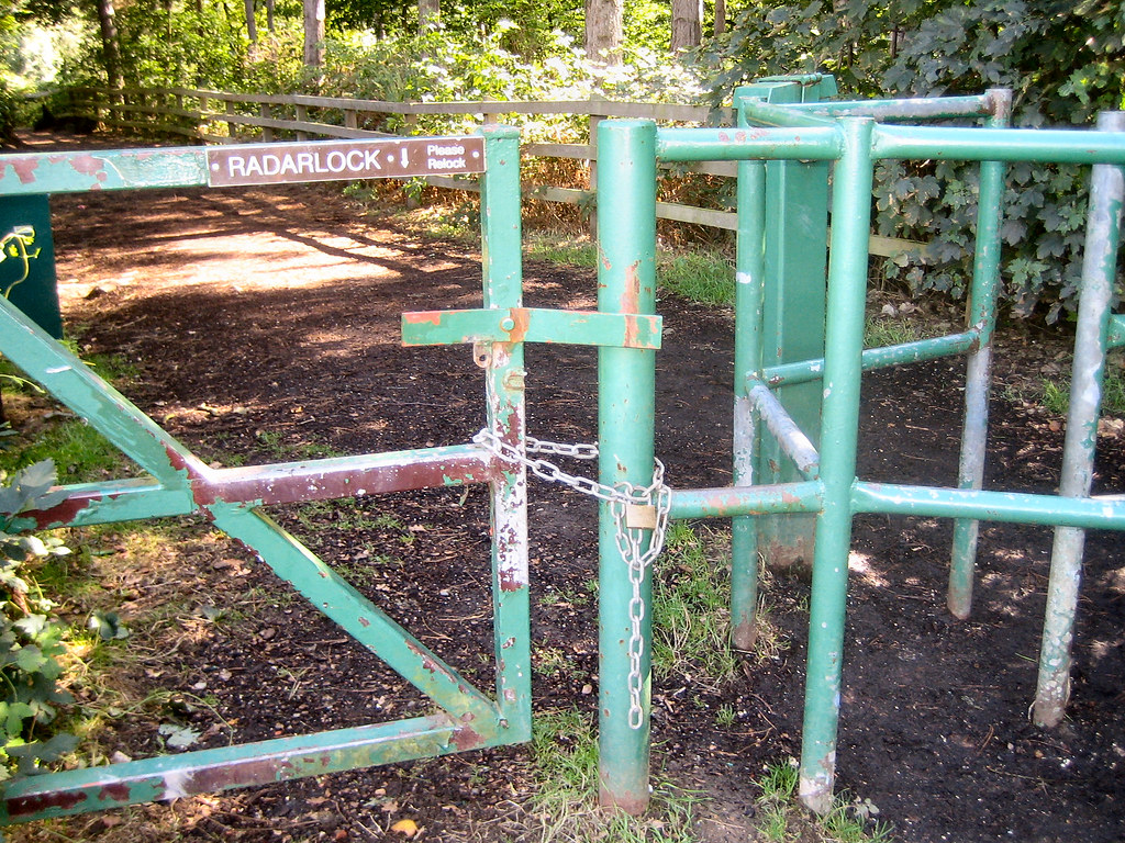
http://static.flickr.com/74/219934689_2b0b4714e7_b.jpg
This also is not a RADAR lock as all disabled people would
know and it is on the vehicle entrance. Somebody has had a
go at it but I cannot. My only solution here is to saw the gate
off and I doubt I am strong enough to do that. Somebody
else will have to tackle that one.
http://static.flickr.com/71/211165160_dd1c261af2_b.jpg
This is the lock on the disabled gate. I couldn't saw through
it so I sawed through the bracket it rests in and wrote to
IBC and told them what I had done including pictures of me
doing it. They have not taken any action against me so far
unfortunately as I would like to hear them in court explain
why they are obstructing Rights OF Way in Ipswich.
http://static.flickr.com/63/219938982_e8a8108eda_b.jpg
IBC locked it up like this and I could not saw it off even if I
wanted to go that way but I informed them if I wanted to go
that way and it was locked I would destroy this effort too.
http://static.flickr.com/85/221418521_9fad8dcaf6_b.jpg
They have now put a RADAR lock on the gate again but
some one has stolen the lock I think:-) Good. It is unlawful
of IBC to block Footpaths even if they
do own them. I hope eventually all the other gates
obstructing Footpaths will also be removed or one of the
local youngsters with a disabled relative will get a disc cutter
and remove all of them instead of waiting for IBC to do it.
If anyone knows I am wrong in law here please advise me
so that I can correct this post and not mislead others.
peterturtill@hotmail.com pics at
http://www.flickr.com/photos/ipswich/

Wednesday, August 16, 2006


This is the map John Hunt is using in his application to have the byways to the river re-opened. http://static.flickr.com/79/217152813_e7f7fcd7cf_b.jpg Point "A" is on Nacton Road by Halfway House on the perimiter of the old airfield. There are a few paths marked on the map but the ones he is campaigning for at the moment are from point "A" through Alnesbourne Priory to points "C & B" on the river bank at Mansbrook where many local people used to camp and picnic. I can remember as many as 50 people being down there at the same time. The other route is from point "A" to point "E & C" through Bridgewood down to the river where many people have camped or just walked. Some have used this route to dig bait and indeed many still do but they can no longer drive down to the river. I and my mates used to ride both these routes on horses we had hired from Joe Wiggins and now John needs more people to fill in forms stating they used one or both routes. With enough forms filled in Suffolk County Council will investigate re-opening these routes so if you would like to fill in a form contact me and John will bring a form to you.

peterturtill@hotmail.com pics at http://www.flickr.com/photos/ipswich/

Wednesday, August 09, 2006


A TOUR OF ALNESBOURNE PRIORY AKA PRIORY PARK. SOME OF THE LINKS BELOW ARE OF EXTRA PICS I TOOK WHILE MEANDERING.

http://static.flickr.com/72/211418695_ec6f8d823f_b.jpg Approaching Alnesbourne Priory.

http://static.flickr.com/76/211418691_e6aec83c17_b.jpg Inside the Priory grounds and into the land of notices.

http://static.flickr.com/80/211418688_a6828338b3_b.jpg Speed humps inside a Priory!http://static.flickr.com/88/211418685_a44fcbec7a_b.jpg To the right of the Old Priory Night Club leads to the residential area. We are going left. http://static.flickr.com/77/211413191_3776a7d682_b.jpg Tennis anyone. There is a swimming pool beside this.

http://static.flickr.com/87/211413188_9461b2f209_b.jpg A brand new old barn. http://static.flickr.com/63/211413184_8efb4b57cf_b.jpg Entrance to the PAYG golf course. http://static.flickr.com/75/211413183_fbdab78002_b.jpg Happy campers in sight now. http://static.flickr.com/82/211413182_92fe51094b_b.jpg Office and place for campers to 'go'. http://static.flickr.com/61/211406710_2c1ad169fb_b.jpg The last site before the river. Boats are on the left.

http://static.flickr.com/94/211406709_8eb353cd9b_b.jpg Returning via the east side of the loop road.

http://static.flickr.com/65/211406708_083ae5c8c2_b.jpg The end of the east loop. http://static.flickr.com/69/211406707_d58994e0c8_b.jpg Back opposite the Priory Night Club that was.

http://static.flickr.com/74/211406706_8091f6b2b8_b.jpg The speed hump from the opposite direction.

http://static.flickr.com/98/211406705_6fdb22349b_b.jpg Slightly closer to the crazy speed humps. Who ever heard of speedhumps on a footpath/bridleway/biway!

peterturtill@hotmail.com pics at http://www.flickr.com/photos/ipswich/

Wednesday, August 02, 2006

ACTUAL FOOTPATHS, BRIDLEWAYS AND VEHICULAR ACCESS I KNOW AND HAVE USED.
Click on pic or here http://static.flickr.com/68/204943436_2f6f0e58e7_b.jpg

This is the same map produced in 1994 by Suffolk County Council with just the main footpaths marked but none are denoted as Bridleways or Vehicular Access Routes.
http://static.flickr.com/82/205200446_5dfc38da52_b.jpg

This is the same map after Mr Peter Little whose company owns Priory Park protested.
http://static.flickr.com/59/204943435_50b772ca2d_b.jpg
Note the Footpath/Bridleway that runs through his land has disappeared. Wonderful what a fat wallet can do isn't it. His son James runs the site now while he runs he Moon and Sixpence site near Martlesham. However this is the 1926 map version.
http://static.flickr.com/76/201357964_01db5179a1_b.jpg
Which shows many Footpaths and obviously the wider tracks are Bridleways as that is how country folk travel around. My map is easily explained I hope. It is the one in the header.
http://static.flickr.com/68/204943436_2f6f0e58e7_b.jpg
The broken red dashes at the top centre trailing off to the right signify a Footpath behind the houses on Nacton Road. This Footpath has now been extinguished at a Public Enquiry in 2000 but it has not been extinguished where it continues down to point 'A' marked A1189. Again from the top centre of the map but leading left and down is another Footpath that hasn't been extinguished and for the length of Maryon Road it was all access points. It continues down through Braziers Wood to the river. The other red lines are Footpaths I have walked for years since 1943+ when my mother took me as a child. Now the main Footpath/Bridleway/Vehicle Access start at the 'A' again where the road marking A1189 is on the map. This is a Footpath/Bridleway/Vehicular Access right down to the river at 'E and C'. This is where the bait diggers and fishermen parked up. There the Vehicular Access stops but it continues as a Footpath/Bridleway right the way back to 'E and B' right through Priory Park but of course access is denied except for favoured people and definitely not for ordinary folks out for a drive or walk. However all these Footpaths/Bridleways/Vehicular Access routes can be restored (except for the one that has been extinguished) if enough people are prepared to make a stand and sign a statement that they have used these routes over a period of years. I only need four people for each application besides myself. There is also a very important fight going on about the Footpath/Bridleway around Ipswich Dock and in particular around the Island as that is also now blocked off. I have just discovered a Public Consultation has been taking place in Suffolk for the last two years. I never heard anything about this 'Public Consultation' so just how much of a consultation as opposed to a decision it is I can but speculate. If you want to make your views known you only have until the end of this month to do so. Here is a link to their 'Mission Statement' if you want to exercise your rights. http://www.suffolk.gov.uk/Environment/PublicRightsOfWay/
peterturtill@hotmail.com pics at http://www.flickr.com/photos/ipswich/
Download Web Counters
Pay Check Loans