 ACTUAL FOOTPATHS, BRIDLEWAYS AND VEHICULAR ACCESS I KNOW AND HAVE USED.
Click on pic or here http://static.flickr.com/68/204943436_2f6f0e58e7_b.jpg
This is the same map produced in 1994 by Suffolk County Council with just the main footpaths marked but none are denoted as Bridleways or Vehicular Access Routes.
http://static.flickr.com/82/205200446_5dfc38da52_b.jpg
This is the same map after Mr Peter Little whose company owns Priory Park protested.
http://static.flickr.com/59/204943435_50b772ca2d_b.jpg
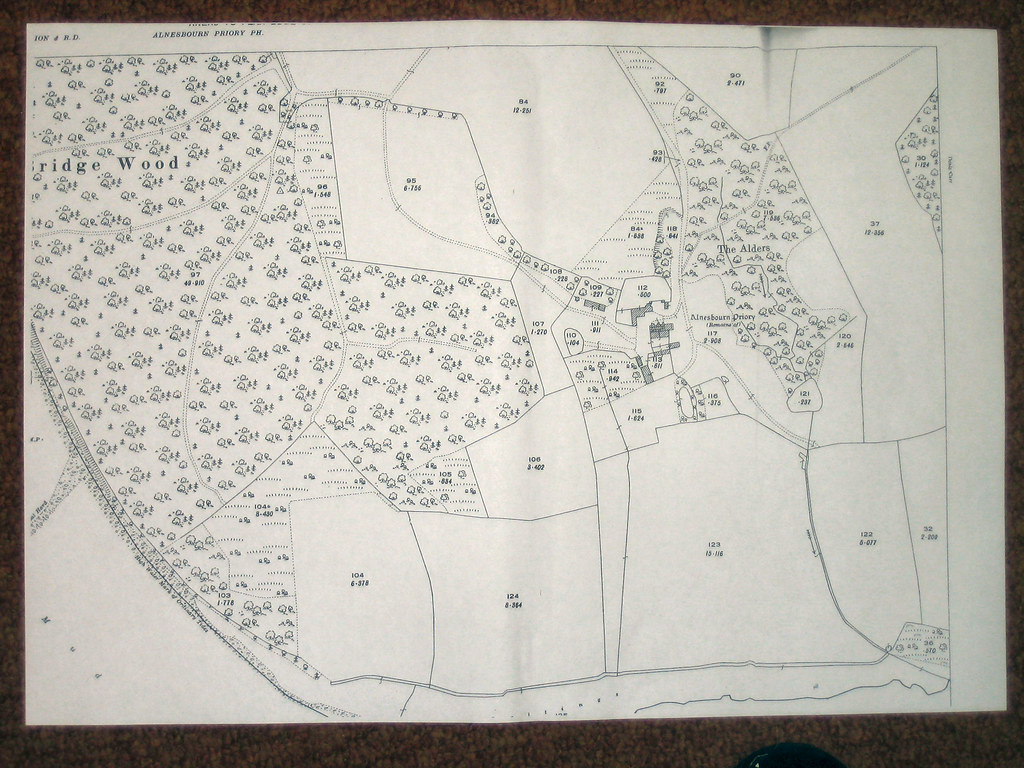
Note the Footpath/Bridleway that runs through his land has disappeared. Wonderful what a fat wallet can do isn't it. His son James runs the site now while he runs he Moon and Sixpence site near Martlesham. However this is the 1926 map version.
http://static.flickr.com/76/201357964_01db5179a1_b.jpg
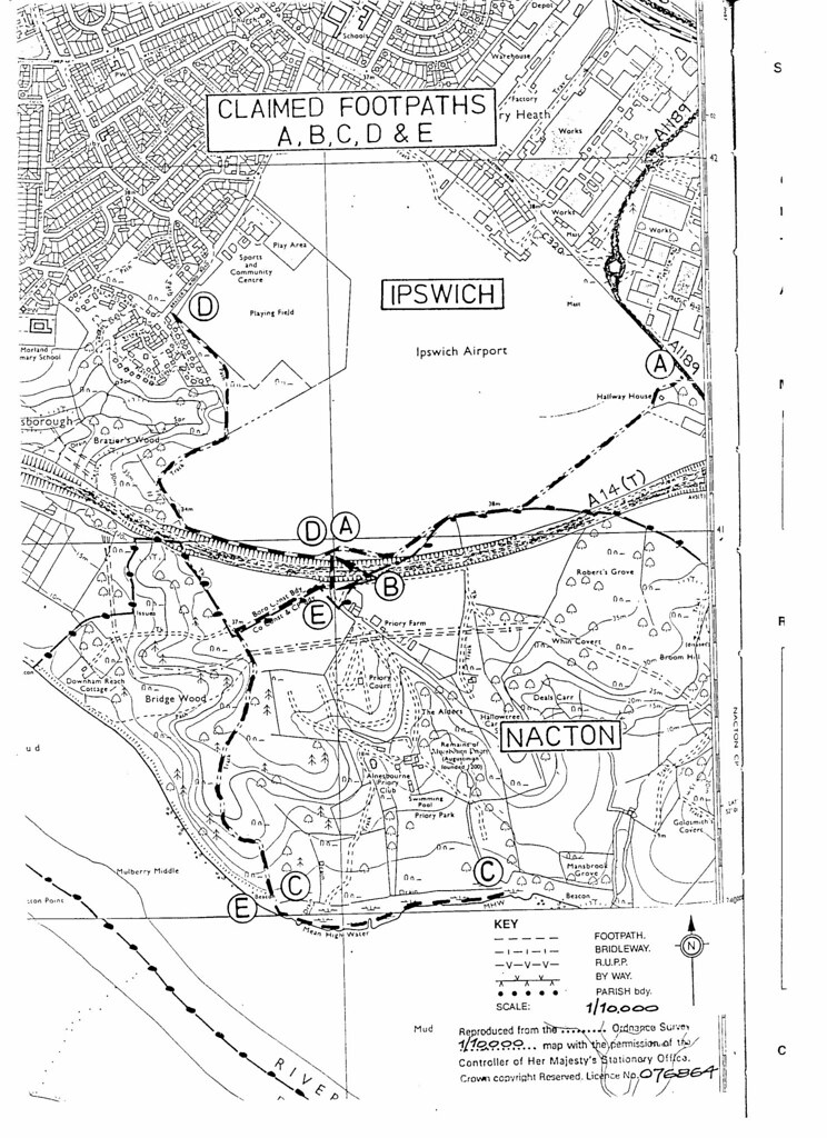
Which shows many Footpaths and obviously the wider tracks are Bridleways as that is how country folk travel around. My map is easily explained I hope. It is the one in the header.
http://static.flickr.com/68/204943436_2f6f0e58e7_b.jpg
The broken red dashes at the top centre trailing off to the right signify a Footpath behind the houses on Nacton Road. This Footpath has now been extinguished at a Public Enquiry in 2000 but it has not been extinguished where it continues down to point 'A' marked A1189. Again from the top centre of the map but leading left and down is another Footpath that hasn't been extinguished and for the length of Maryon Road it was all access points. It continues down through Braziers Wood to the river. The other red lines are Footpaths I have walked for years since 1943+ when my mother took me as a child. Now the main Footpath/Bridleway/Vehicle Access start at the 'A' again where the road marking A1189 is on the map. This is a Footpath/Bridleway/Vehicular Access right down to the river at 'E and C'. This is where the bait diggers and fishermen parked up. There the Vehicular Access stops but it continues as a Footpath/Bridleway right the way back to 'E and B' right through Priory Park but of course access is denied except for favoured people and definitely not for ordinary folks out for a drive or walk. However all these Footpaths/Bridleways/Vehicular Access routes can be restored (except for the one that has been extinguished) if enough people are prepared to make a stand and sign a statement that they have used these routes over a period of years. I only need four people for each application besides myself. There is also a very important fight going on about the Footpath/Bridleway around Ipswich Dock and in particular around the Island as that is also now blocked off. I have just discovered a Public Consultation has been taking place in Suffolk for the last two years. I never heard anything about this 'Public Consultation' so just how much of a consultation as opposed to a decision it is I can but speculate. If you want to make your views known you only have until the end of this month to do so. Here is a link to their 'Mission Statement' if you want to exercise your rights. http://www.suffolk.gov.uk/Environment/PublicRightsOfWay/
peterturtill@hotmail.com pics at http://www.flickr.com/photos/ipswich/
posted by pete at 6:03 PM
![]()
![]()


2 Comments:
Hi Pete, I am a bait digger. Are you saying I should be able to drive down to the river again?
Jim
Only if enough people come forward and state they have done so and make a statement to that affect. It only needs five but the more the better and then we would all be able to drive down to the river again.
pete
Post a Comment
<< Home