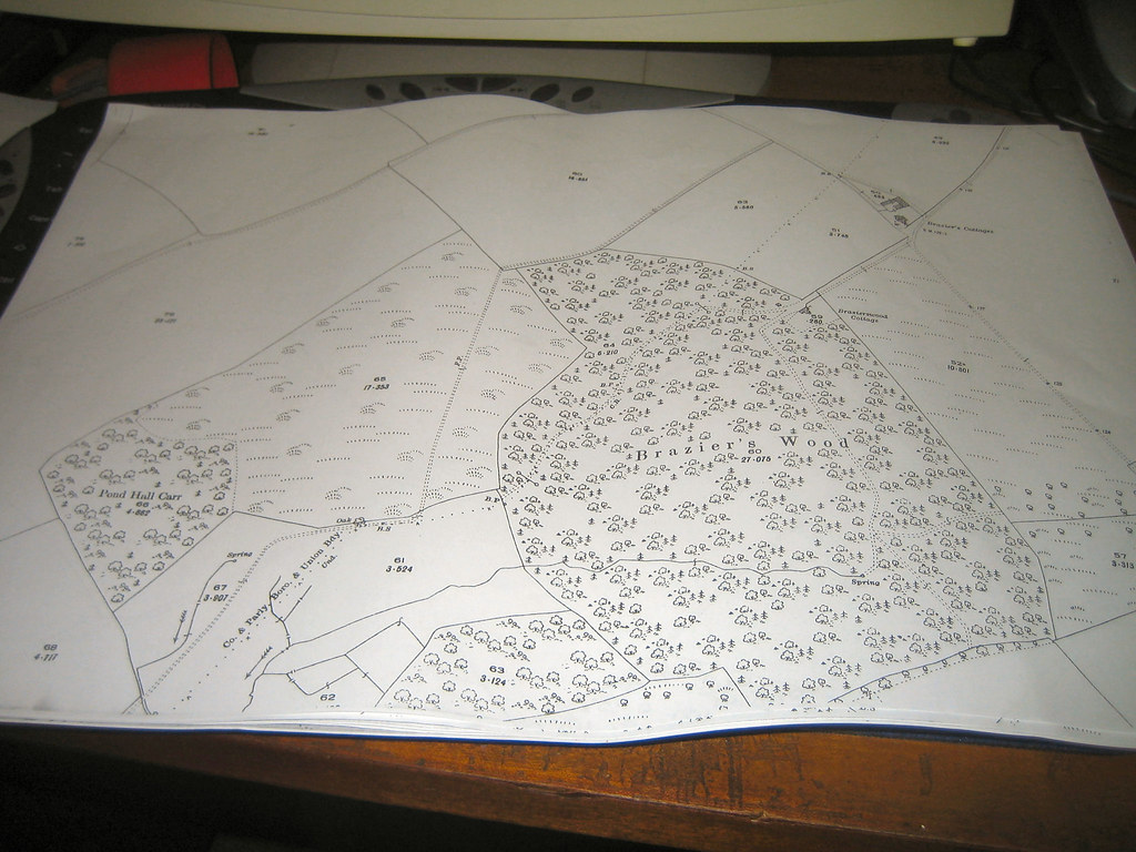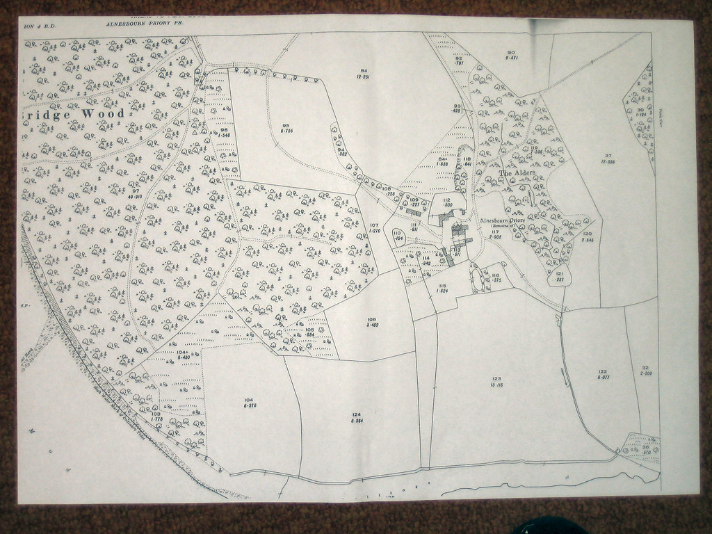


MAP OF BRAZIER'S WOOD AND BRIDGE WOOD AND SOME OF NACTON ROAD.
http://static.flickr.com/57/201331576_27be7bebd9_b.jpg This is nine sheets of photocopy laid rather haphazardlyto give an idea of the area taken from a 1926 map.
http://static.flickr.com/61/201331578_69013e05dd_b.jpg The top of Bridgewood Interestingly showing a footpathleading down to Pond Hall.
http://static.flickr.com/58/201331579_9eaae1428d_b.jpg Brazier's Wood again. Note the larger of the Brazierswood cottages. This is probably now the junction of Clapgte Lane and Brazier's Wood Road. Also note the fantastic array of footpaths.
http://static.flickr.com/75/201331582_f8b9e21302_b.jpg This shows much clearer the Brazierswood Cottages and the footpathleading from it to the top of the page which is Nacton Road. One side of Maryon Road where is joins Nacton Road is now the Golden Hind pub and opposite is a bungalow my grand mother owned some 60/70 years ago.
http://static.flickr.com/57/201357962_055f4d3498_b.jpg Two sheets of another 1926 map showing Bridgewood and the massof footpaths through it.
http://static.flickr.com/58/201357963_875a173e32_b.jpg Bridge Wood closer up At the top right a three way junction offootpaths can be seen. From the word 'only' go down to thefirst set of horizontal dotted lines. This is the presentboundary between IBC and Suffolk Coastal Council and where it runs into the three way junction is where IBC have erected illegal gates. Mr Vuliamys house is not shown in Bridge Wood so I can only assume it was not built in 1926 and Downhamreach is shown to be nearer Brazier's Wood than the house.
http://static.flickr.com/76/201357964_01db5179a1_b.jpg More of Bridge Wood and the old Priory ruins and of coursemasses of footpaths. Click on any of the hyperlinks or pics to see an enlarged version.
peterturtill@hotmail.com pics http://www.flickr.com/photos/ipswich/


0 Comments:
Post a Comment
<< Home